I went to the open house last night on the most recent iteration of the project to add ramps to and from 35W on the north side of Lake St – officially and awkwardly titled I-35W Transit/Access Project, but which I’ve dubbed ARCH (Access to the Region’s Chinese/Hibachi buffet). Since Minnescraper has tragically fallen into a coma, instead of my typical obsessively researched and revised essays (not that you could tell) I’m just going to post my unvarnished thoughts here .
History Lesson
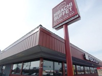
Hibachi Buffet/Trip Generator
In the late 90s, as the internet was evolving from its primary function as a venue for competitive Happy Days trivia to a multipurpose mass media celebrity gossi pdelivery mechanism, some entrepreneurs realized that bricks-and-mortar video rental would soon become obsolete, so they approached the City about their idea of eventually replacing a Blockbuster near the 35W/Lake St interchange with the Twin Cities’ premier Chinese/Hibachi buffet. The City realized that demand for new restaurant would soon overwhelm existing infrastructure, so they teamed with the County, MnDot and a partnership of nearby benevolent corporations to brainstorm ways to accommodate the coming onslaught of buffetgoers.

The old Access project had some grandiose touches
They came up with a modest project that would widen Lake St to add a landscaped center median with plenty of room for turn lanes, crate a full diamond interchange at Lake and a ramp from northbound 35W to 28th St, close the ramps at 35th/36th and add a replacement with a big ole roundabout thing at 38th St, demolish the Metrodome and replace it with a retractable-roof stadium, and if there was still money left over, build a transit station at Lake. Needless to say, they couldn’t find funding, and the project died as planning efforts shifted to meet the new capacity challenges caused by an expanding chain of suburban Hibachi grill buffets.
Then the dreaded day finally came when Blockbuster closed and was replaced by the future, to which the masses thronged. Officials could no longer put off the needed upgrades to local crumbling infrastructure and planning for ARCH was rekindled. And then they had an open house yesterday.
Huh?

No more median on Lake it seems
So I guess the difference now is that the 35/36 exits have been dropped, and I don’t know if the Braid Bridge (where southbound 35W crosses over the northbound 35W exit to Downtown) was part of the old Access project, but it is now. Also, the idea of widening Lake St seems to have been dropped, which is interesting because I thought that was why they left so much of Lake St unreconstructed a few years ago. So pretty much all they’re looking at is how many ramps to add to Lake St, whether a ramp should be added to 28th, and what the transit station is going to look like. At the open house, in addition to free cookies, they had a cool model of the project area, and most portentously an enormous roll-up layout of the option that would include a full Lake St interchange and an exit from northbound 35W to 28th. I interpreted that as meaning that they will do a full build if they can.
The Transit Station
Perhaps it’s obvious, but I was most interested in the transit station component. It seems they’ve settled on a side platform configuration, which I was disappointed about because center platforms are much better from a passenger’s standpoint. It turns out that I wasn’t the only one who was disappointed – the project has an advisory committee composed of a gaggle of local interests, and they came to the conclusion that a center platform was better, too – only to be overruled by MnDot, who decided at some point that they were too afraid of an errant driver entering the station area and smacking head-on into a bus to allow it (nevermind that MnDot has operated a reversible facility on 394 for two decades without a serious incident). The advisory committee members were understandably irked that they had spent so much time on something that had already been decided.
But after talking with a consultant at the open house, the side platforms make a lot more sense to me. A lot of buses are going to be using this station – today there are 70-80 buses an hour at peak but it’s being designed for 90-100 buses per peak hour. That last figure would be a bus about every half-minute on average, and the guy I talked to mentioned that entry gates don’t really work at that frequency, which I believe. The other advantage to side platforms is they allow for wider lanes in the station (22.5′ each), making it easier for buses to pass each other. Anyone who’s ridden Nicollet Mall at rush hour knows how important that is.
Transit so frequent your trees turn translucent
So I’ve been won over to side platforms for this station, although I still am opposed to making that the standard. Certainly there needs to be a lot more study of Freeway BRT networks before we can choose a station design based on a freak accident that may or may not ever happen. Considering our griddish freeway network, it seems likely that transfers are going to be crucial in a built-out Freeway BRT network, and crucial to transfers are center platform stations. It may be that dual-side door vehicles will be needed for this reason – someone at MnDot or the Met Council needs to get off their ass and commission the study of the transit technology that they killed heavy rail transit for in the 70s, but haven’t even gotten around to thinking about yet.
The 28th Street Exit
28th Street must have some friends in high places in order to be considered for an exit. The only point along its length where it sees more than a handful of cars a day is just east of 2nd Ave S, which is basically an extension of the exit from 35W. If I were in charge, I’d ask for a promise of expanded employment before I built an exit there, since it seems just as easy to handle those cars on Lake St and then any of the major arterials that are spaced every 1/8th of a mile east of 35W.
26th and 28th run through some of the densest neighborhoods in town, and don’t come anywhere close to needing the capacity they’re built to. They could each be converted to two-lane two-ways with left turn lanes at intersections and center turn lanes in the busiest segments with no loss of parking and using existing curb geometry. The City has been ignoring the neighborhoods’ request for two-way conversions for years. I get that in projects like ARCH the large institutions will get their way, but when they build that 28th St exit for Wells Fargo and Allina, they better build it in a way that can accommodate a two-way conversion.
24th St/Braid Bridge

1st google hit for “minneapolis skyline” is taken from the 24th st bridge
Way up on the northern fringe of the project runs 24th Street, which at 35W becomes a narrow pedestrian bridge that is the source of approximately 97% of pictures of the Minneapolis skyline. This bridge isn’t necessarily involved with the ARCH project except that any funding for ARCH will also likely include funding for the Braid Bridge, which is pretty thoroughly ancient and also is maybe sort of awkward to merge with (source?). The big roll-up layout of the proposed full bridge moves the Braid Bridge slightly to the north, which frees up some possibilities with 24th St that according to the consultant I spoke with have barely been explored thus far.
One possibility I heard mentioned more than once at the open house, though, was to replace the Franklin overpass with upgraded pedestrian facilities and then not replace the 24th St pedestrian overpass at all. That would be a terrible idea. Fair Oaks and West Phillips are two of the densest neighborhoods in the city, and they’ve been separated by a freeway for decades. They need every bridge they can get. I’m not aware of any standards on pedestrian bridge spacing (of course, even though we have extremely detailed official standards for slant parking). I would say that in this kind of setting, 1/4 mile is the minimum spacing for pedestrian crossing.
Will this thing ever end?
I think the ARCH project – like the 35W Access Project that proceeded it – is one of the most interesting projects around. Balancing the needs of basically every type of mobility in the heart of a neighborhood that’s been ravaged by past government actions, it requires sensitive proceedings of whatever government agency is unlucky enough to take it on. And for the most part they seem to be delivering. They say they’ll be at 30% design for the project by the middle of 2013, which means the construction will be complete in approximately 2999. We’ll see how the project will have changed by then, after many more open houses to come.

What you’re referring to as the “Braid Bridge” wouldn’t be funded under “ARCH”. It actually falls under the Chapter 152 Bridge program created when the Legislature passed the gas tax increase over Pawlenty’s veto a few years ago. As such, it’ll be funded from the gas tax increase revenue dedicated to Chapter 152. It’s also required by law to be under contract by 2018…the current schedule has it for 2016.
Wow, that’s interesting. I assumed that they would both come from federal surface transportation funds. I’ll have to look into that Chapter 152 Bridge program. I got the impression at the open house that they were basically rolling the two projects together, but that may not work out if ARCH runs into the same political obstacles that foiled it before.
Some of the plans show the braid bridge bringing southbound 35W over both north and southbound former TH65. This would allow a southbound HOT lane starting right at downtown, and it would reduce weaving to the new southbound exit to Lake Street.
As part of this braid bridge project, we could slightly lower the grades of the highway, and add a full bridge at 24th street to reconnect the neighborhoods.
Yes that was the plan presented at the open house. Thanks for clarifying the rationale, which I couldn’t quite put together in my head. Wish they’d post that layout on the website somewhere.
Federal STP funds may well be used, as well as Federal bridge funds. But since the “Braid bridge” is one of the 172 bridges statewide that fall under the Chapter 152 program, it has a dedicated funding stream at the state level. This is the same bridge program that’s paying for the Lafayette and Cayuga bridge replacements.
I can see why they’d roll the two projects together…both would have a major impact on southbound 35W traffic so they probably want to do them together at once instead of stringing them out. Funding for the Access Project will be the determining factor here.
28th handles much more than a handful of cars each day and that’s the reason the neighborhoods want to return it to two-way operation. We have hundreds of vehicles speeding down 28th a half block from our house every day. I like the convenience aspent of the 26th/28th pair but it really is not a safe place to be a pedestrian.
The whole project is excessive. Get a reasonable bus station at Lake St., put in elevators so the disabled can access it and call it a day. If we’re going to spend lots of money we ought to spend it putting I-35W below grade at Lake St. Even better, make Lake St. a land bridge.
For once, let’s put the neighborhoods first.
Yeah I agree about 28th – what I was trying to say is that it handles a lot less cars than it’s built for. And a lot of those cars are induced by the overcapacity and one-way layout, and would use I-94 if 26/28 were converted to two-way.
I agree completely. I would also want to see parking on both sides of those streets, particularly 28th. There’s plenty of space.
I doubt that. I-94 is too far north given the relatively short distance that 28th travels…it effectively only goes between Hennepin and Hiawatha.
The ones that are looking for a drive without a lot of stops or already coming from the north will take I-94 – it’s only a half-mile up from 26th, which is a fifth the distance between Hennepin and Hiawtha. The ones that are just looking for the quickest drive will take Franklin, 26th, 28th, 31st, or even 35/36. It’s tough to know for sure but we can say with certainty that almost no one will switch to Lake. My guess is that Franklin will get more traffic-calming, which doesn’t tend to appeal to the people who like one-way pairs.
I should elaborate on my point. I don’t see a lot of traffic diverting to I-94 if 26th/28th goes 2-way for the simple fact that, not only is it over a mile extra round-trip, but local access to/from 94 in that area is very limited. The only people I could see doing it are those going all the way from Hiawatha over to Uptown or back. Those “already coming from the north” are already on 94 for that same fact…almost no local exit ramps. It’d take an origin-destination study to know for sure but I’d hazard a good bet that there aren’t many drivers who are taking 26th or 28th for the full distance between Hennepin and Hiawtha.
Hmm. I didn’t realize there would be quite that many buses. I mentioned on Minnescraper that Peter Wagenius said I-35W carried more transit passengers than the Hiawatha Line does — that’s almost certainly wrong, but he might have intended to refer to how many vehicles pass through in a day. I suppose it’s also possible that there are more passengers going through there in peak hours, and Hiawatha just wins because it operates 20 hours a day 7 days a week rather than mostly being confined to rush periods.
I have to agree with you on the 24th street pedestrian bridge — it’s pretty appalling that they’d suggest removing it. I understand that the neighborhoods had to fight for the bridge for a decade or two after I-35W was built, and it doesn’t make any sense to me to go through that all over again.
Hopefully moving the braid bridge farther north would allow a new pedestrian bridge to be built which wouldn’t need to rise as high above the highway, which would help with bike-friendliness and ADA-compliance on the east end.
Most of I-94 between downtown Minneapolis and Saint Paul has pedestrian crossings spaced 1/4-mile apart, and this part of I-35W should be treated similarly.
My guess is that Hiawatha has also more reverse peak riders – I think that same document said that there are only 20-25 reverse peak buses per hour.
That’s a good point about ADA-compliance on the 24th St bridge – that thing has a mighty hump. Uncharacteristically, I’d support exploring the possibility of building the replacement to handle vehicular traffic, for purposes of transit routing of course.
I like the idea of making 24th a real bridge and I don’t think we’d have to restrict it to transit-only. I see what you’re getting at but people who live in the area do still own cars and 24th is an important secondary route through much of South Minneapolis. It would be even more so with 26th/28th reverted to bidirectional operation.
That said, I would want to see a bike/ped friendly bridge with greenery, etc.
Yeah I agree with that but I didn’t want to come right out and say it…
It is wrong. While specific numbers are hard to come by unless you can wrangle them directly from the transit operators or the Met Council, I’ve consistenly seen a number for the 35W corridor in the range of 15K a day. By comparison, this Hiawatha LRT facts sheet from last year says the line had 10.5 million riders in 2010…that comes out to an annualized average of about 28,700 a day. If these numbers are even remotely correct, Hiawatha ridership is close to twice that of the I-35W buses combined.
Bummer, forgot to go to the meeting last night!
Have to say I like the idea of a ramp to 28th for a few different reasons. I understand and want to fully support the neighborhoods but I think it would be beneficial to leave 28th and 26th as one ways and give the freeways access. Granted I have selfish reasoning, I’m a cab driver, but having access to Phillips and Whittier from 35w would have the potential to significantly reduce the traffic in the merge from the 35w/94 Hennepin Lyndale exit easing congestion throughout the 94/35 commons, Uptown and Phillips and every ones happy! The capacity is already there to handle the added traffic from the freeway and I bet you could even get away with reducing the three lanes on 26th down to two, 28th down to three lanes (or two) instead of FIVE and adding a bike lane and parking. Or better yet! What about a tree lined median separating the new bike lane from traffic instead of adding parking, it would prevent what the Mayor of Toronto calls a door prize and reduce the scale of those streets. Add better means of travel without cars and you reduce your need for parking and costly freeway improvements.
I’d be willing to try lane reductions first, but my guess is that there is something about the design of one-ways that encourages unsafe speeds, so is inappropriate for neighborhood settings regardless of how convenient they are.
Love your site by the way.
Your probably right… It would be nice to see the local law enforcement step up efforts to actually enforce the traffic laws in this city. The revenue could be used for the street enhancements 🙂
And thanks!!!
Yuck. No way I’d support an exit ramp to 28th. People speed too fast through there already. The 35/94/Hennepin/Lyndale backups are almost entirely due to people not knowing how to merge. That is, it is not a requirement to merge right where the solid line becomes dashed (or in the case of Hennepin/Lyndale, even BEFORE the double-white goes away).
Traffic problems in the commons is hugely exacerbated by clueless drivers. Let’s fix that first before constructing expensive and potentially harmful transportation infrastructure.
Is that layout of Lake Street real? what’s with the eastbound left turn onto northbound Stevens? Won’t Stevens need to be a one way southbound to accommodate the southbound off-ramp (there IS a southbound off-ramp, right?)
Regarding the platform location, I don’t have a preference for center or side stations… but isn’t it problematic that 46th Street station is center and this one will be on the side? Didn’t we just spend millions constructing center HOT lanes, in part to provide transit advantage for buses? Isn’t this project similarly envisioned to extend those HOT lanes further north, still center-aligned? Isn’t this going to force hundreds of buses to have to weave across 4-5 lanes of freeways to get from the center at 46th to the outside at Lake St? Is this forcing buses to choose either to stop at Lake Street OR take advantage of HOT lanes? Is the likely result of this decision that a lot of buses are going to choose to not stop at Lake Street if it’s easier to stay in the HOT lanes? Or am I missing something about this project?
It’s real, but it was kind of sneaky for me to use it to show that the Lake St median is no longer in the running. It’s actually illustrating a scenario in which only the overpass is replaced, so including a transit station but not including the additional ramps, from this presentation:
Click to access Lake%20St%20Part%201%20Dec%2015-11%20PAC.pdf
I’m really bummed that the website doesn’t have the graphics from the open house (they told me it would, or I would have taken pictures). There were some boards that clearly showed that the median was no longer being considered, but all I can find on the website is this presentation, in which renderings depict a median-less Lake, but in a cartoony way:
Click to access 00051_I-35_Dec15_2011.pdf
The latter presentation also has some more details about the transit station configuration – it would remain in the center of the roadway, and accessed by the HOT lanes, but within that space, platforms would be on the side rather than in the center like 46th.
Re: station location. OH. I get what you’re saying about center/side. I was way off.
Oh, and to answer your question about Stevens, if I remember right, yes it would be a one-way southbound if the southbound off-ramp were constructed. The full build of the project does include that off-ramp (as well as an off-ramp from nb 35W to 28th St and an on-ramp from Lake St to nb 35W), but the past political opposition to a similar (though much larger) project provides some uncertainty about whether the full build can be done. If I remember right, the southbound off-ramp to Lake involves two full takings and two partial.
A bunch of stuff has been added from the open house.
Here are the drawings and whatnot.
http://www.35lake.com/graphics/