Links to historic Twin Cities transit maps, listed chronologically with publisher in parentheses.
1885 – Minneapolis only. Street railway lines shown on plates, except Motor Line. (???)
1888 – Minneapolis only. (Mpls City Directory Publishing Co.)
1889 – Minneapolis only. David Rumsey also has a version of this map that he dates to 1901, but it’s identical as far as I can tell. The next two maps have features that don’t appear on the supposed 1901 map, so I’m assuming the earlier date is correct. (George F. Cram)
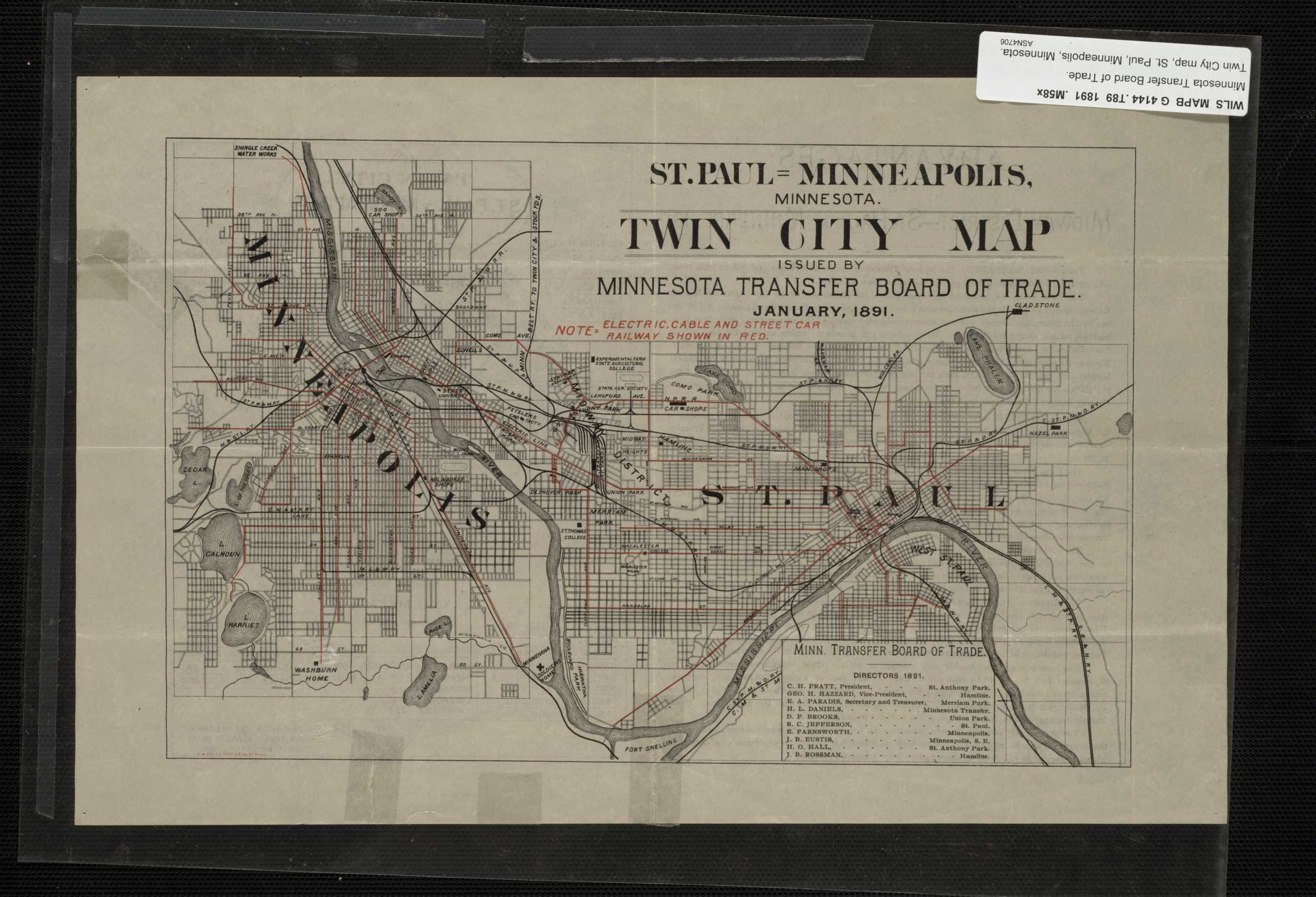
1891 (MN Transfer Board of Trade)
1892 – Minneapolis only. (C.M. Foote & Co.)
1897 (Rand, McNally & Co)
1898 (Northwestern Map Publishing Co.)
1900 – Minneapolis only. (Hudson)
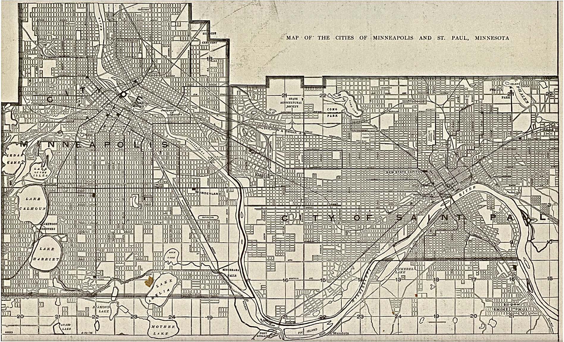
1901 – The U of M’s Borchert map library also has a 1903 map from R.L. Polk & Co but it appears to be identical. I don’t necessarily trust directory maps, but included this because it dates from the brief period that Lake Calhoun was renamed Lake Mendoza. (Edit – The Hennepin County Library claims that the Dakota name for Lake Calhoun is Mde Medoza, so it seems likely that Polk & Co just got that name wrong.) (R.L. Polk & Co.)
1903 – Minneapolis only. (Mpls Real Estate Board)
1906 (TCRT)
1906 (Francis J. Reynolds)
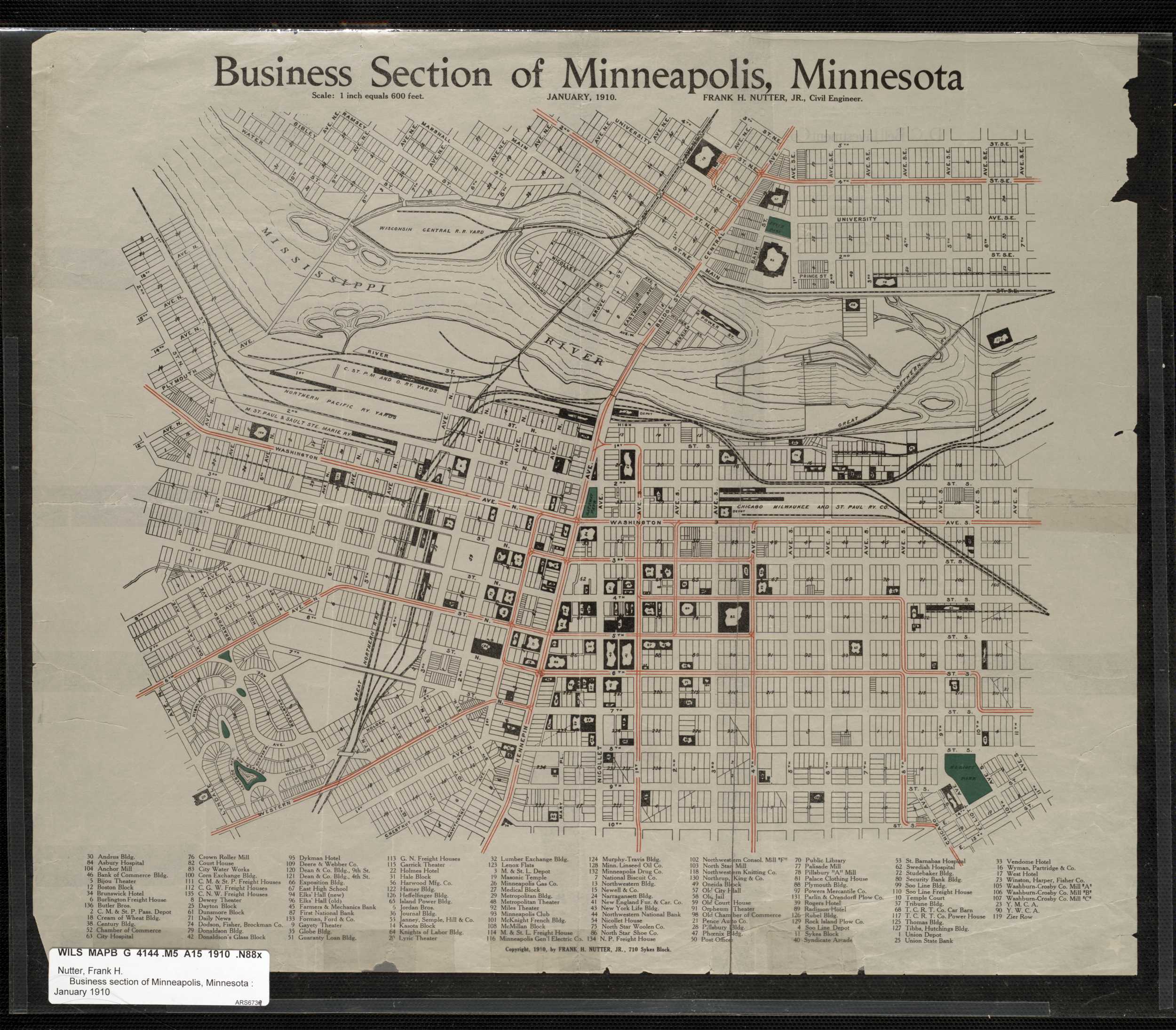
1910 – This is Downtown Minneapolis only, but is cool because it shows the actual tracks. (Nutter, Frank H.)
1911 (TCRT)
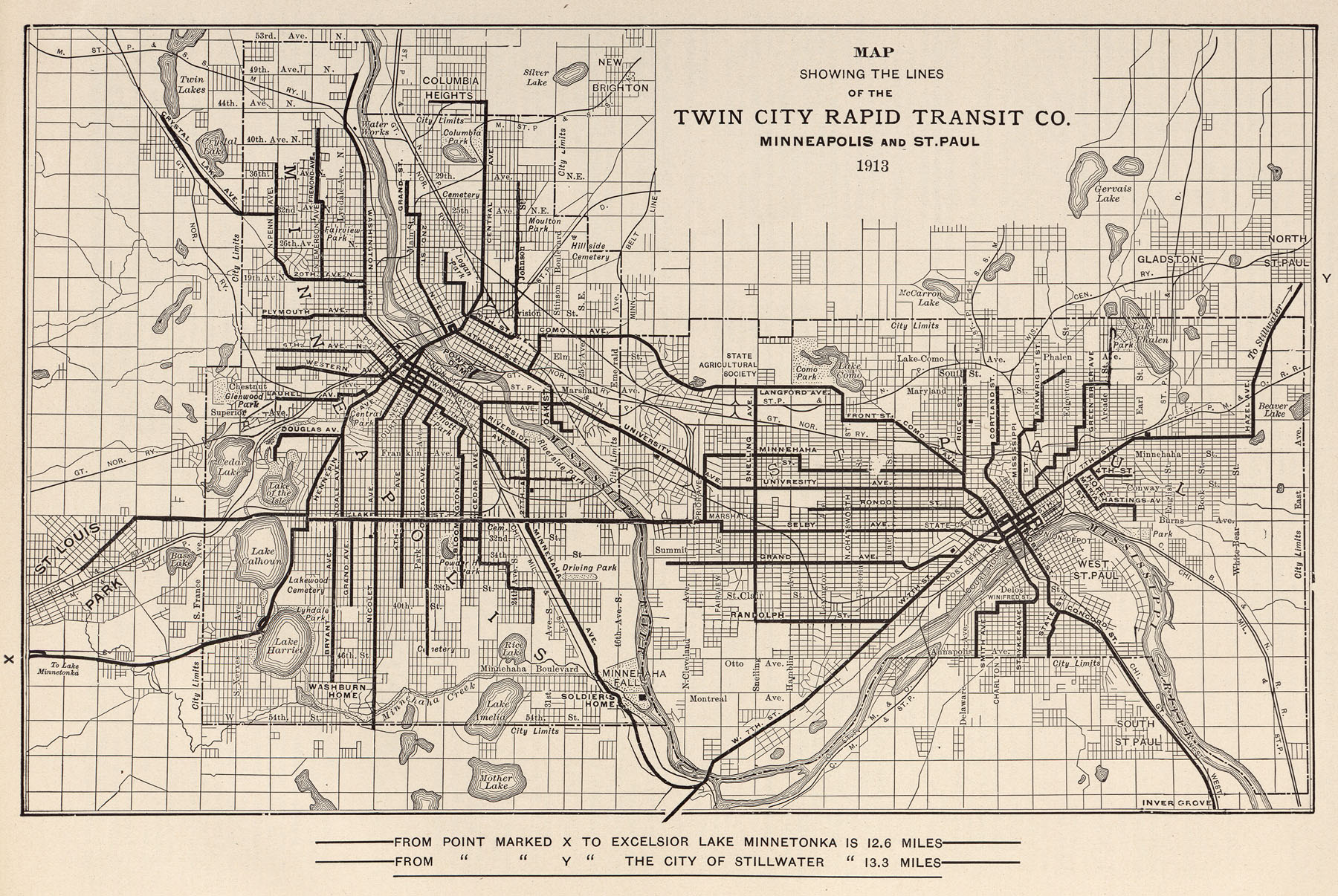
1913 (McGraw Electric Railway Manual)
1914 (McGraw Electric Railway Manual)
1915 (TCRT)
1917 (TCRT)
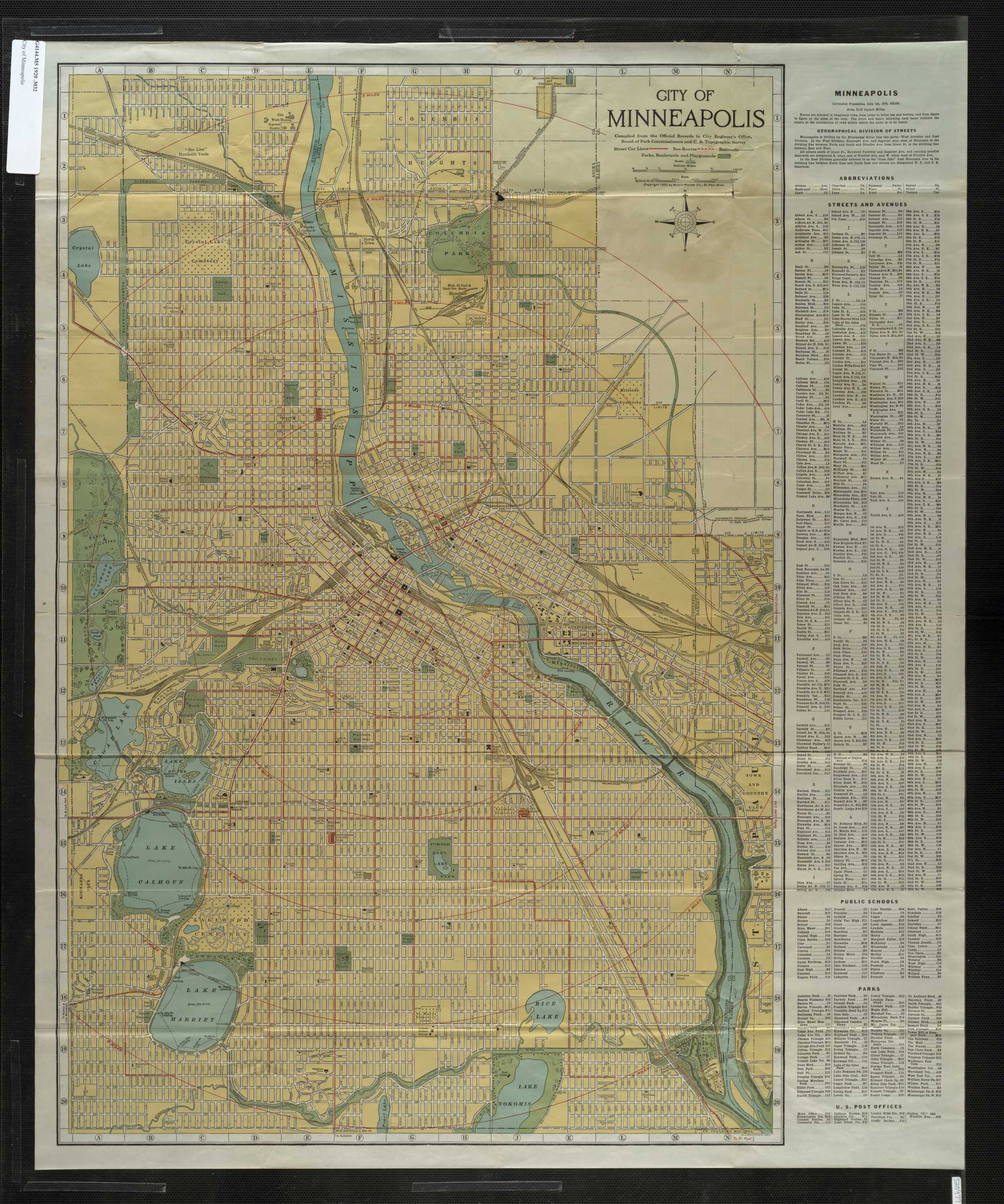
1920 – Minneapolis only (McGill-Warner Co.)
1946 – Minneapolis only (TCRT)
1948 (TCRT)
1948-1950 – kmz version of the 1946 map above, if you want to view it in Google Earth (TCRT)
…
Notice anything strange about this list? What’s up with the 26 year gap after 1920? Is this a symptom of the beginning of the decline of streetcars? Did Americans begin to be more obsessed with the newfangled automobiles, and save scarce colored ink for highways? Am I just a feeble googler?
Please link in the comments to any streetcar maps of the past that I missed.

I think copyrights explain the gap after 1920. Everything published prior to 1923 is in the public domain, but things after that get more complicated.
[…] a snap to plan a bus network. Still, Minneapolis’ bus routes clearly continue to follow the old streetcar lines rather than adapt to changing circumstances. I don’t know the history of the MBTA, but […]
Hello! Great post, thanks for pulling all these together. I did a map of the streetcar system a few years ago. The track system was at its height around 1933. The track system slowly shrank after that. Though the system remained fairly large until ’50 or so, it disappeared entirely by around ’53. Ridership was steadily shrinking in the last years. Local authors I’ve read say that automobiles were the main culprit, although the company was mismanaged as well. Also, TCRT had to pay for snow removal on tracks, whereas if they switched to buses on that route they did not. Twin Cities by Trolley by Diers and Isaacs is pretty comprehensive and has lots of good photos and maps. Thanks again.
Thanks for the comment, Brett. I’d be interested in seeing your map – feel free to link to it in the comments.
This is a wonderful collection. Thanks. I’ll put a link to the blog on my neighborhood’s (Columbia Park) web site. FYI, I learned about this blog via Strong Towns site.
Thanks Pete. Glad you like it.
[…] A map of transit-oriented development in Minneapolis-St. Paul. Source. […]
Many of the links are broken